

Arlington Virginia Distracted Driving 2026: Clarendon, Wilson Boulevard and the DC Metro Commuter

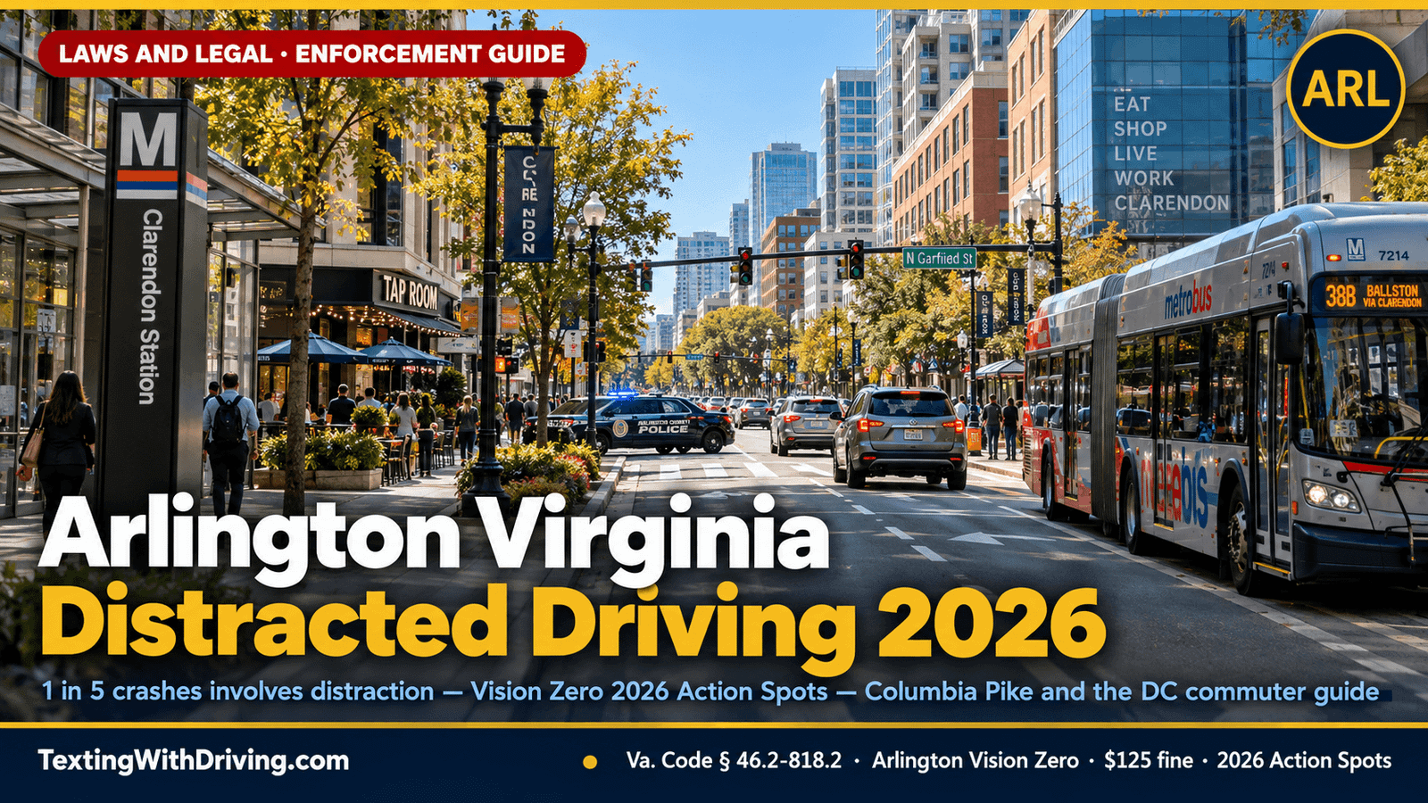
Arlington Virginia Distracted Driving 2026: Clarendon, Wilson Boulevard and the DC Metro Commuter
Arlington Virginia distracted driving 2026 operates in Virginia’s densest county — a 26-square-mile jurisdiction of approximately 240,000 residents that is simultaneously one of the most walkable, transit-rich, and pedestrian-intensive communities in the Commonwealth, and the home of Amazon’s HQ2, the Pentagon, and the Crystal City-Pentagon City-Rosslyn corridor that anchors Northern Virginia’s most concentrated employment district.
At least 1 in 5 fatal or severe crashes in Arlington involves distraction. That data point from Arlington County’s own Vision Zero Public Education Toolkit — based on crash data from 2020 to 2025 — establishes distracted driving as the documented behavioral factor in 20 percent of Arlington’s most serious crashes. And Arlington’s own acknowledgment is the conservative figure: we also understand that distraction is underrepresented in crash data since it’s not always easy to confirm or prove.
Arlington is a county where the driver who holds their phone is surrounded by pedestrians on every block, cyclists on protected lanes, scooter riders on shared-use paths, and Metrobus riders stepping off buses at stops where the curb is inches from the travel lane. The specific density of the pedestrian-vehicle conflict environment in Clarendon, Columbia Pike, and the Rosslyn-Ballston corridor makes the consequence of distracted driving’s failure-to-detect mechanism more immediately lethal than in suburban environments where pedestrian density is lower.
This guide covers the complete Arlington Virginia distracted driving 2026 picture: Arlington’s Vision Zero data on distracted driving crash concentration, the 2026 Action Spots on Wilson Boulevard and Columbia Pike, the specific enforcement environment, the Amazon HQ2 commuter dimension, and what every Arlington resident, Pentagon commuter, and Rosslyn-Ballston transit rider must know under Virginia Code § 46.2-818.2.
Arlington’s Distracted Driving Data: 1 in 5 Crashes
Arlington Virginia distracted driving 2026 begins with the Arlington Vision Zero program’s own crash data analysis — one of the most granular available for any Northern Virginia jurisdiction.
At least 1 in 5 fatal or severe crashes in Arlington involves distraction based on crash data from 2020 to 2025. The 20 percent distraction attribution in Arlington’s crash data is a minimum figure — the actual share is higher because distraction is underrepresented in crash data since it’s not always easy to confirm or prove.
Arlington’s Vision Zero baseline established approximately four traffic fatalities per year and approximately 55 severe crashes before the program’s intensive intervention. Through August 2024, Arlington recorded 29 total severe and fatal crashes — tracking toward approximately 44 on an annualized basis, suggesting meaningful improvement from the 55-severe baseline.
The High Injury Network concentration is the most actionable data point in Arlington’s crash picture: 78 percent of Arlington’s serious or fatal crashes happen on just 7 percent of Arlington streets. That 7 percent of streets — the High Injury Network corridors — includes Columbia Pike, Wilson Boulevard, Washington Boulevard, Lee Highway (Route 29), and the Rosslyn-Ballston corridor. These are not obscure back roads. They are Arlington’s primary commercial and commuter arteries, traveled by hundreds of thousands of vehicles every day.
The intersection concentration within the HIN is equally specific: 7 out of 10 serious pedestrian or bicycle crashes occurred at an intersection, and 20 percent of all serious and fatal crashes in Arlington were turn-related crashes. The turn-related crash — a driver making a turn who fails to detect a pedestrian or cyclist in the crosswalk or bike lane — is the specific behavioral failure that phone-distracted turning behavior produces. A driver making a left turn on Wilson Boulevard while holding their phone is in exactly the scenario where the 1-in-5 distraction attribution is most likely to produce the 7-in-10 intersection pedestrian crash outcome.
Arlington’s 2026 Action Spots: Where the Data Points
Arlington Virginia distracted driving 2026 has a specific geographic focus in Arlington’s 2026 Vision Zero Action Spots — the intersections identified through crash data analysis as requiring immediate safety intervention.
The 2026 Action Spots published by Arlington’s Vision Zero program include six specific intersections, three of which flag all-crash concentration, pedestrian crash concentration, and equity area designation simultaneously:
Columbia Pike & Dinwiddie Street. Flagged for all crashes, pedestrian crashes, and equity area. Columbia Pike through the Dinwiddie Street corridor is in Arlington’s most densely populated and transit-intensive section of the Pike — where bus stops, crosswalks, and pedestrian movement from the dense apartment and mixed-use buildings along Columbia Pike create the highest pedestrian-vehicle conflict frequency of any corridor in the county.
Columbia Pike & Greenbrier Street. Flagged for all crashes and pedestrian crashes. The Greenbrier Street intersection on Columbia Pike is within the Columbia Pike Multimodal Street Improvements project area — the long-running VDOT and Arlington collaborative project redesigning Columbia Pike for bus rapid transit, protected pedestrian crossings, and reduced vehicle speed.
Columbia Pike & S Frederick Street. Flagged for all crashes, pedestrian crashes, and equity area. The Frederick Street intersection is in the southern portion of the Columbia Pike corridor where the highest concentration of lower-income residents, transit-dependent pedestrians, and nighttime pedestrian activity produces the specific pedestrian vulnerability that the equity area designation reflects.
Columbia Pike & Glebe Road. Flagged for all crashes, pedestrian crashes, and equity area. The Glebe Road intersection is one of Columbia Pike’s highest-traffic cross-street intersections — where the full volume of Glebe Road’s north-south traffic meets the full volume of Columbia Pike’s east-west traffic in a complex multi-phase signalized interchange.
Wilson Blvd & Washington Boulevard. Flagged for all crashes and pedestrian crashes. The Wilson/Washington Boulevard intersection in the Clarendon-Courthouse corridor is the 2026 Action Spot that most directly represents the Clarendon entertainment district’s pedestrian-vehicle conflict environment — and the specific turning-movement crash scenario that the Wilson Boulevard Safety Audit identified as the primary crash mechanism on this HIN corridor.
Shirlington Road & Arlington Mill Drive. Flagged for all crashes and pedestrian crashes. The Shirlington Road intersection serves the Shirlington Village commercial district — a walkable mixed-use neighborhood that draws pedestrian activity from the surrounding apartments and the Signature Theatre complex.
Wilson Boulevard and Clarendon: What the Safety Audit Found
Arlington Virginia distracted driving 2026 on Wilson Boulevard has a specific evidence base in Arlington’s Vision Zero High Injury Network Safety Audit of Wilson Boulevard from North Arlington Ridge Road to North Randolph Street.
The Wilson Boulevard Safety Audit identified the specific crash factors concentrated on this corridor: distraction, pedestrian activity, speeding, rain and mist conditions, and senior driver involvement. Distraction is the first-listed behavioral factor in the audit’s crash analysis — establishing it as the leading documented behavioral contributor to Wilson Boulevard’s crash pattern.
Arlington’s intersection improvements at Clarendon Circle — completed March 2020 as part of the Clarendon Sector Plan and the Clarendon Multimodal Transportation Study — produced a specific result: zero severe or fatal crashes, and a decrease in pedestrian and bike crashes after the new updates. The Clarendon Circle infrastructure improvement demonstrates what Arlington’s Vision Zero approach produces at specific locations: a high-crash intersection with documented distraction and pedestrian crash factors was redesigned, and severe crashes eliminated.
The Wilson Blvd & Washington Boulevard 2026 Action Spot designation — indicating the intersection has not yet received the infrastructure intervention that Clarendon Circle received — means this specific location is in the pre-improvement period where the distraction-plus-pedestrian crash risk is still at baseline levels. A driver on Wilson Boulevard approaching the Washington Boulevard intersection who is holding their phone is at the specific 2026 Action Spot intersection that Arlington’s own crash data has identified as requiring priority intervention.
The Clarendon entertainment district context adds the nighttime dimension: Wilson Boulevard through Clarendon carries the post-restaurant and post-bar traffic that creates the late-night pedestrian-vehicle conflict environment we documented for Virginia Beach’s oceanfront in our Virginia Beach distracted driving 2026 article. Clarendon’s density of restaurants, bars, and entertainment venues — combined with the DC metro workforce’s young-adult demographic that uses these establishments — creates the specific weekend-evening pedestrian density on Wilson Boulevard where the 1-in-5 distraction crash attribution is most consequentially concentrated.
Columbia Pike: Arlington’s Highest-Crash Corridor
Arlington Virginia distracted driving 2026 has its highest crash concentration on Columbia Pike — the primary east-west arterial running from the Pentagon area westward through the high-density mixed-income neighborhoods of southern Arlington toward Falls Church.
Columbia Pike appears in four of Arlington’s six 2026 Action Spots — the most concentrated crash data signal available in Arlington’s entire road network. The Columbia Pike Multimodal Street Improvements project — a years-long redesign of the corridor for bus rapid transit, protected pedestrian crossings, and traffic calming — is Arlington’s largest single investment in the specific environment where its distracted driving crash concentration is highest.
Columbia Pike is not just a crash corridor. It is Arlington’s most economically and demographically diverse corridor — serving Latino, Ethiopian, Eritrean, Vietnamese, and immigrant communities that are among the most transit-dependent and pedestrian-active populations in the county. The equity area designations on three of the four Columbia Pike Action Spots reflect the specific connection between pedestrian vulnerability, transit dependence, and crash concentration that makes Columbia Pike’s safety not just a traffic engineering issue but a transportation equity issue.
A driver on Columbia Pike who is holding their phone — navigating to a grocery store, coordinating a pickup at the bus stop, managing a work call during the morning commute along the Pike toward I-395 — is in the specific corridor where Arlington’s distraction crash data is most concentrated, where pedestrian density is highest, and where the equity dimension of who gets killed makes the behavioral choice most consequential.
The Amazon HQ2 and Pentagon Commuter Dimension
Arlington Virginia distracted driving 2026 has a specific employment center dimension that distinguishes Arlington from every other Virginia jurisdiction in terms of the specific commuter behavioral profile it attracts.
Amazon’s HQ2 in Pentagon City and Crystal City — as documented in our Alexandria Virginia distracted driving 2026 and Loudoun County distracted driving 2026 articles — brings the technology workforce demographic that NHTSA identifies as the primary distracted driving risk group directly to Arlington’s densest pedestrian environment. Amazon employees commuting to HQ2 in the 21-35 age range — driving or riding-sharing from Northern Virginia, Maryland, and DC — are on Arlington’s road network during the morning and evening peaks on Columbia Pike, Route 1, and the Crystal Drive/Army Navy Drive corridor.
The Pentagon complex brings a separate commuter stream: defense and intelligence workers, many with security clearances that make a reckless driving conviction specifically consequential as documented in our Virginia reckless driving and distracted driving 2026 article. The Pentagon’s massive parking structure and the associated morning and evening traffic flows on South Hayes Street, Army Navy Drive, and the Pentagon City corridor create the high-density driving environment where Columbia Pike’s crash concentration extends into the Pentagon approach roads.
The Reagan National Airport dimension adds the rental car and rideshare pickup dimension we documented for Virginia Beach’s tourist environment: drivers unfamiliar with Arlington’s road network, trying to navigate to the airport on Crystal Drive while holding their phone for navigation, are in the specific HIN-corridor environment where the 1-in-5 distraction crash rate applies.
Automated Safety Enforcement: Arlington’s Camera Infrastructure
Arlington Virginia distracted driving 2026 enforcement includes both the Virginia Code § 46.2-818.2 primary officer enforcement that applies on every Arlington road and the automated camera enforcement that Arlington has been deploying as part of its Vision Zero Automated Safety Enforcement initiative.
Arlington’s Automated Safety Enforcement program — referenced in the 2025 mid-year Vision Zero report as a continuing initiative — deploys speed cameras at specific HIN locations and school zones within the county’s road network. The program expansion in fall 2024 added 12 or more Leading Pedestrian Intervals at high-risk crossings — the signal timing change that gives pedestrians a head start before conflicting vehicle traffic is given a green light.
The Virginia SB84 camera framework that deployed Obvio AI cameras in school zone crosswalks and at stop signs — documented in our Virginia distracted driving cameras 2026 article — applies in Arlington’s school zones alongside the county’s own automated enforcement infrastructure. An Arlington driver who passes a stop sign in a school zone while holding their phone potentially encounters both SB84’s civil citation authority and Arlington’s speed camera infrastructure on the same block.
The specific intersection improvements at Clarendon Circle that produced zero severe crashes since 2020 demonstrate what the engineering interventions accomplish. But the 2026 Action Spots still lacking those improvements — including Wilson Blvd & Washington Boulevard — remain in the pre-improvement baseline period where driver behavior is the primary safety variable.
The Rosslyn-Ballston Corridor and Metro Station Pedestrian Flows
Arlington Virginia distracted driving 2026 has a specific Metro station pedestrian concentration that is unique in the DMV: the Rosslyn-Ballston corridor contains five Orange and Silver line Metro stations — Rosslyn, Court House, Clarendon, Virginia Square-GMU, and Ballston — within approximately three miles of Wilson Boulevard. Each station generates substantial pedestrian flow during morning and evening peaks as riders enter and exit via station entrances directly on or adjacent to Wilson Boulevard.
The Metro station pedestrian flow creates the specific conditions where distracted driving on Wilson Boulevard is most dangerous: dense waves of pedestrians crossing at station-adjacent crosswalks during the 7-9 AM and 5-7 PM peaks, when the transit rider who has been on their phone during the train ride immediately transitions to a pedestrian crossing the street while still looking at their phone — creating mutual distraction that the 1-in-5 crash attribution’s acknowledged undercount may specifically reflect.
The Rosslyn-Ballston corridor is also the specific location where the through-traffic from I-66 entering Arlington on the Rosslyn interchange creates the high-speed-to-urban-arterial transition that produces rear-end and angle crashes when distracted drivers fail to adapt to the reduced speeds and increased pedestrian activity of Wilson Boulevard after exiting the highway.
The Street Smart Campaign in Arlington’s Pedestrian Corridors
Arlington Virginia distracted driving 2026 is addressed by the Metropolitan Washington COG’s Street Smart campaign — which Arlington explicitly participates in alongside Alexandria, Montgomery County, and Prince George’s County. Arlington Families for Safe Streets, the Pedestrian Advisory Committee, and the Clarendon Alliance are all documented Arlington Vision Zero stakeholder groups engaged in the public education component that the camera and enforcement infrastructure complements.
Arlington’s Vision Zero team published a Public Education Toolkit specifically addressing distraction that includes the finding that at least 1 in 5 fatal or severe crashes in Arlington involves distraction and the Virginia law’s $125 first offense fine. The toolkit represents Arlington’s commitment to behavior change through education alongside the engineering interventions at Action Spots and the enforcement through both officer-based primary citation and automated camera enforcement.
What Every Arlington Driver and Commuter Must Know
Arlington Virginia distracted driving 2026 creates specific compliance obligations for every driver in this 26-square-mile county where pedestrian density, transit connectivity, and the documented 1-in-5 distraction crash rate combine to make phone use while driving particularly consequential.
Virginia Code § 46.2-818.2 is $125 first offense on every Arlington road. From Columbia Pike to Wilson Boulevard, from Crystal Drive to Lee Highway, from Route 50 to Route 1 — every public road in Arlington applies the same first-offense $125 primary enforcement standard. Arlington County Police, Virginia State Police, and other authorized agencies have primary stop authority on all of these roads.
The 2026 Action Spots at Wilson/Washington and six Columbia Pike intersections are Arlington’s documented highest-risk locations. If you drive through any of these intersections regularly, you are navigating the specific locations that Arlington’s crash data analysis has identified as requiring priority safety intervention. Holding your phone through these intersections is choosing distraction at the exact location where the data shows distraction is already contributing to crashes.
The Amazon HQ2 and Pentagon workforce security clearance consequence applies. As documented in our Virginia reckless driving and distracted driving 2026 article, a reckless driving conviction from distracted conduct while holding a phone produces a criminal record that security clearance reinvestigation will encounter. The HQ2 corridor on Crystal Drive and the Pentagon approach roads are within 1 mile of multiple Action Spots on Columbia Pike and Route 1.
Clarendon’s nighttime pedestrian density makes post-dinner-hour driving the highest-risk window. The 1-in-5 distraction crash data does not specify time-of-day concentration, but the Clarendon entertainment district’s pedestrian density — diners leaving restaurants, bar patrons crossing Wilson Boulevard, rideshare pickups creating the double-parked vehicle obstruction that forces pedestrians into the travel lane — peaks in the 9 PM to 2 AM window when the combination of darkness, alcohol-adjacent pedestrian behavior, and driver distraction creates the most concentrated crash risk on Arlington’s HIN.
For the complete Virginia law that applies on every Arlington road, our Virginia distracted driving law covers Va. Code § 46.2-818.2. For the DC border-crossing enforcement context that makes Arlington’s law one component of the DMV commuter’s daily legal landscape, our DC Virginia Maryland commuter distracted driving laws 2026 covers every jurisdiction transition. For the Amazon HQ2 and Crystal City context connecting Arlington to the broader Northern Virginia technology corridor, our Loudoun County distracted driving 2026 covers Data Center Alley’s commuter connection. And for the technology setup that makes Arlington compliance automatic on Columbia Pike, Wilson Boulevard, and every Arlington road, our hands-free while driving complete setup guide covers iPhone, Android, Bluetooth, and CarPlay.
Sources Used in This Article
All links verified working before publication.
Arlington County Vision Zero Public Education Toolkit — Distraction — At least 1 in 5 fatal or severe crashes Arlington involves distraction 2020-2025, distraction underrepresented crash data, Virginia § 46.2-818.2 $125 first offense, Arlington Vision Zero goal eliminate all fatal severe crashes by 2030, 2026
Arlington County Vision Zero 2026 Action Spots Infosheet — Six 2026 Action Spots: Columbia Pike Dinwiddie, Shirlington Rd Arlington Mill, Columbia Pike Greenbrier, Columbia Pike S Frederick, Wilson Blvd Washington Blvd, Columbia Pike Glebe Rd; all crashes pedestrian crashes equity area designations, 2026
GGWash: Arlington County Moves Forward Vision Zero Plan — Four fatalities per year 55 severe crashes baseline, 78% serious fatal crashes on 7% streets HIN, 20% turn-related crashes, 7 in 10 serious ped bike crashes intersections, pedestrians quarter serious over half fatal crashes, $16 million programs decade, Vision Zero Action Plan
Arlington Vision Zero HIN Wilson Boulevard Safety Audit — Crash factors distraction pedestrian speeding rain mist senior, zero fatal crashes since 2019, Clarendon Circle improvements completed March 2020 zero severe fatal crashes decrease ped bike after improvements
Arlington Magazine: Arlington’s Top 10 Traffic Crash Zones — 2,052 total crashes 2022, Vision Zero working fewer crashes more drivers, Columbia Pike multiple top intersections, Columbia Pike S Arlington Blvd construction phase
Arlington County Vision Zero 2026 Action Plan Update and 5-Year Plan — 2026-2030 five-year action plan update, ongoing Vision Zero metrics tracking, VZAC newsletters 2026
NHTSA: Distracted Driving — 3,208 deaths 2024, national context
TextingWithDriving.com is professionally built and maintained to ensure accurate, accessible safety information reaches every driver who needs it. Website development and ongoing support is handled by Budgetic, a digital agency specializing in purpose-driven WordPress websites.
